Toggle navigation
Página Inicial
Navegar
Comunidades e coleções
Navegar por:
Data do documento
Autores
Títulos
Assuntos
Tipo de Documento
Sobre
Entrar
Entrar
Toggle navigation
JavaScript is disabled for your browser. Some features of this site may not work without it.
Coleção de Cartografia: Recent submissions
Itens para a visualização no momento 1-20 of 84
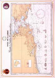
Brasil - Rio de Janeiro: carta náutica comemorativa
Diretoria de Hidrografia e Navegação
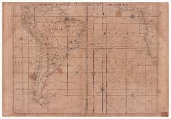
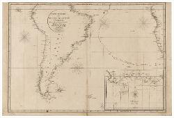
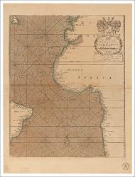
A New Map, or Chart in Mercators Projection of The Ethiopic Ocean with Part of Africa and South America
Herbert, William
A New chart of the coast of Brazil from Maranham to Rio de Janeiro drawn from the latest surveys By W.m Heather
Heather, William
A chart of the Bay or Harbour of Rio de Janeiro in South America : according to the Latest Observations
Gilbert, William
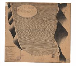
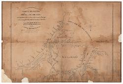
Plano da armação de Garupaba : cituada na costa da Terra Firme pertencente a Freguezia da Enciada de Britto, mandado ellevar pelo Governador Interino da Ilha de Santa Catharina João de Miranda Ribeiro em 1799 Desenhado por Joaquim Joze de Francici Partidista do Numero de Aula de Art.a e Fortificação da Cidade do Rio de Janeiro
Francici, Joaquim Joze
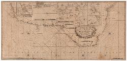
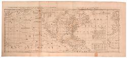
Carta General del Oceano Atlantico Meridional : construida con presecia de las publicadas por la Direccion Hydrografica de Madrid, y otros conocimientos modernos / Por D.n Jose de Espinosa Gefe de Esquadra de la Real Armada
Espinosa, José de
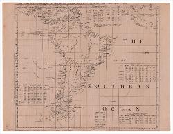
A New and correct chart of the Western and Southern Oceans : shewing the variations of the compass according to the latest and best observations / Sold by W. & I. Mount & T. Page, on Tower Hill London
Mount, William
Chart containing the greater part of the South Sea to the south of the line, with the islands dispersed thro' the same. : South America with the adjacent Islands in the Southern Ocean and South Sea
Jefferys, Thomas
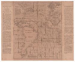
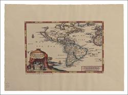
America, of Nieuw-Ontdekte Weereld : tot de Beschryving van Joseph D' Acosta afgebakend
Aa, Pieter van der
Chart of South America : comprehending the West Indies, with the Adjacent Islands, in the Southern Ocean, and South Sea
Jefferys, Thomas
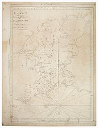
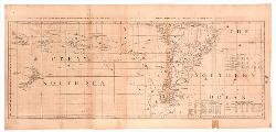
Chart, containing the coasts of California, New Albion, and Russian discoveries to the north; with the Peninsula of Kamtschatka, in Asia, oppofite thereto; and Islands, dispersed over the Pacific Ocean, to the north of the line. : North America and the West Indies with the opposite Coast of Europe and Africa
Jefferys, Thomas
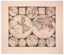
Planisphaerium terrestre, sive terrarum orbis : planisphaericè constructi repraesentatio quintuplex: adjunctis aliquibus astronomicae geographiae tyrocinii
Allard, Carel
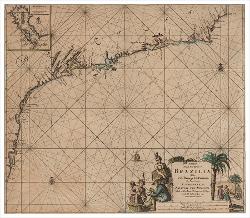
Paskaart, Van De Zee-Kusten Van, Brazilia, Tusschen, C. S. Thome en I. S. Catharina
Keulen, Joannes van
A chart of north and south America, including the Atlantic and Pacific Oceans, with the neareft coasts of Europe, Africa and Asia
Jefferys, Thomas
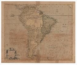
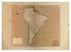
South America: agreeable to the moft approvid maps and charts
Kitchin, Thomas
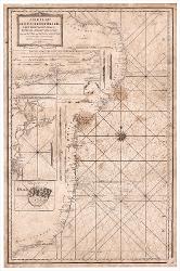
A new chart of the coast of Brazil from the banks of St. Roque, to the Island of St. Sebastian : with the islands and soundings in the offing
Sem autor
South America with its several divisions: according to the possessions of the European powes
Kitchin, Thomas
A Generall chart from England to Cape Bona Espranca: with the Coast of Brasile
Sem autor
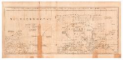
Carta plana da Costa do Brazil: que comprehende entre as sallinas e o cabo do norte e Ilhas adjacentes que corre para a boca do Rio dos Amazonas e Rio do Para
Koeler, Julio Frederico
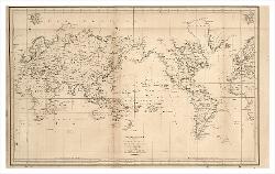
Mappemonde ou carte réduite des parties connues du globe, pour servir au voyage de La Pérouse, fait dans les années 1785, 86, 87, et 88
La Perouse, Jean-François de Galaup
Sobre
Apresentação
Navegar
Todo o repositório
Comunidades e Coleções
Por data do documento
Autores
Títulos
Assuntos
Tipo de Documento
Esta coleção
Por data do documento
Autores
Títulos
Assuntos
Tipo de Documento
Minha conta
Entrar
Cadastro